Before the Spring Festival, a wide range of rain and snow will freeze, and there will be heavy snow or heavy snow in 10 provinces.
Today, the area around South China is still covered with rain, with thick clouds and sunshine disappearing.
Today, the clouds in Guangdong, Guangxi and Hainan are still thick.
With the deepening of the south branch trough moving eastward and the strengthening of warm and humid airflow, the precipitation in China will increase obviously. Tomorrow and the day after tomorrow, there will be moderate to heavy rain and local heavy rain in southern Jiangnan, western and northern South China. At this time, the cold air has not yet moved south, and the warm and humid airflow is dominant, mostly with stable rainfall.
From the 31st, as the cold air gradually flows southward and meets the warm and humid air, it will trigger a round of precipitation process with more rain and snow, longer duration, wider coverage and complicated phase changes of rain and snow.
Compared with the rain and snow process in the south just past, at present, the snowfall center in this process is a little north than last time.During the rain and snow process from January 21 to 23, the snow line in the south was pressed to the south, most of the south of the Yangtze River was dominated by snow, and there were heavy blizzards or heavy blizzards in Loudi, Xiangtan, Hengyang and Zhuzhou in Hunan.

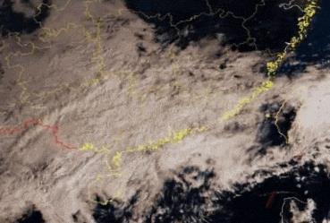
Photo: Central Meteorological Observatory
The Central Meteorological Observatory predicts that from January 31 to February 5, there will be a large-scale continuous rain, snow and freezing weather in the central and eastern regions of China.Blizzard or heavy blizzard will appear in 10 provinces.The accumulated snowfall in Henan, Shandong, Hubei and other places is extreme, and there will be freezing rain in Henan, Hubei, Anhui, Hunan and Guizhou provinces.The rain in the south of the Yangtze River is not weak, accompanied by lightning. It is expected that the rain and snow will last the longest and have the widest impact since this winter.
The rain and snow weather is mainly due to the superposition of the south branch trough and the north branch trough, which is beneficial to the southwest warm and humid air flow northward. The process has the characteristics of wide rain and snow coverage, long duration, large freezing rain range and extreme accumulated precipitation in some areas.

Wide coverage of rain and snow: this rain and snow process basically covers the whole central and eastern regions.In Huanghuai and its northern area, snowfall is dominant, with rain turning to sleet or snow in Jianghan, western Jianghuai, western Hunan and eastern Guizhou. Some areas in eastern and southern Shaanxi, southwestern Shanxi, southern Hebei, Henan, Shandong, Hubei, northwestern Hunan, eastern Guizhou, eastern Liaoning, eastern Jilin and other places have blizzards, local blizzards or heavy blizzards, and the cumulative snowfall is 10 ~ 20 mm, and the local area exceeds 30 mm. There is moderate to heavy rain in the middle and lower reaches of the Yangtze River and most parts of the south, and heavy rain in some areas;From 1 ST to 4 th, it was accompanied by a wide range of lightning weather.
Long duration:The rainy and snowy weather in the central and eastern regions began on January 31st and lasted for 6 days until February 5th. Six days later, there was still weak rain and snow in the eastern part of southwest China, southern Jiangnan and southern China, and the weather in the northern part of Jiangnan and most parts of the north turned fine.

Cumulative precipitation distribution in the next 10 days.
Wide range of freezing rain:From February 1 to 4, there were freezing rains in parts of southern Henan, Hubei, northern Anhui, central and northern Hunan and eastern Guizhou.
On the whole, the rain and snow weather process in the central and eastern regions of this round has lasted the longest since this winter, with the most provinces experiencing freezing rain. The accumulated snowfall in Henan, Shandong and Hubei is close to or exceeds the historical period, which is extreme. However, its duration, low temperature intensity and freezing range are not as good as the freezing process of low temperature rain and snow in southern China in early 2008. The range and intensity of snowfall in the south of the Yangtze River are also weaker than that in January 21-22, with rainfall as the main factor.
Compared with the unusually heavy rain and snow, the temperature is relatively stable. In the next 10 days, the temperature in the southeastern part of the northwest, Huanghuai, Jianghan and the western part of the south of the Yangtze River will be 1 ~ 3℃ lower than normal, and the temperature in most other parts of the central and eastern regions will be close to normal or slightly higher.

In particular, the weather that Cantonese people are most afraid of is coming! Tomorrow night, fog and returning to the south in most cities and counties in Guangdong tend to be obvious. Please try not to mop the floor first, the doors and windows are closed, and the weather is wet. You should be more careful when walking on the wet ground. You can spread newspapers, paper covers and other non-slip objects in the corridor.

The weather is complicated before the Spring Festival.
A wide range of rain and snow is at the peak of returning home before the Spring Festival.
It will have a great impact on roads, railways and aviation.
It is suggested that all localities should do all kinds of emergency preparations in advance.
Strengthen the management of traffic safety and urban operation.
The public reasonably arranges travel plans.
In addition, the forecast time limit of this process is long.
The later forecast may be adjusted.
Still need to pay close attention.
(Source: China Weather Network WeChat)
[Editor: Jin Xin]
[Source: China Weather Network WeChat public account]
Reporting/feedback